Compartir
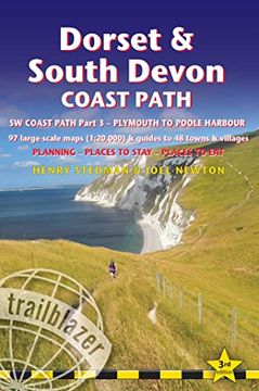
Dorset & South Devon Coast Path: (Sw Coast Path Part 3) - Includes 97 Large-Scale Walking Maps & Guides to 48 Towns and Villages - Planning, Places to (en Inglés)
Henry Stedman
(Autor)
·
Joel Newton
(Autor)
·
Trailblazer Publications
· Tapa Blanda
Dorset & South Devon Coast Path: (Sw Coast Path Part 3) - Includes 97 Large-Scale Walking Maps & Guides to 48 Towns and Villages - Planning, Places to (en Inglés) - Stedman, Henry ; Newton, Joel
$ 306.61
$ 613.23
Ahorras: $ 306.61
Elige la lista en la que quieres agregar tu producto o crea una nueva lista
✓ Producto agregado correctamente a la lista de deseos.
Ir a Mis Listas
Origen: Reino Unido
(Costos de importación incluídos en el precio)
Se enviará desde nuestra bodega entre el
Martes 11 de Junio y el
Miércoles 19 de Junio.
Lo recibirás en cualquier lugar de México entre 1 y 3 días hábiles luego del envío.
Reseña del libro "Dorset & South Devon Coast Path: (Sw Coast Path Part 3) - Includes 97 Large-Scale Walking Maps & Guides to 48 Towns and Villages - Planning, Places to (en Inglés)"
This guide covers the third and last section of the South West Coast Path, from Plymouth to Poole Harbour (217 miles). This beautiful route includes 95 miles within England's only Natural World Heritage Site, the Jurassic Coast, and passes dramatic cliffs and headlands, Chesil Bank's impressive spit and Lulworth Cove, winding through idyllic seaside villages such as Beer and Lyme Regis.- 97 maps large-scale walking maps - at just under 1:20,000 - with unique mapping features: walking times, directions, tricky junctions, places to stay and eat, points of interest. These are not general-purpose maps but fully-edited maps drawn by walkers for walkers.- Itineraries for all walkers - whether walking the route in its entirety or sampling the highlights on day walks and short breaks- Practical information for all budgets - Where to stay (campsites, hostels, B&Bs, pubs and hotels), where to eat, what to see- Comprehensive public transport information for day walks - all access points on the path- Downloadable gps waypoints

