Celebremos el mes del libro hasta 70% y envío gratis  Ver más

menú

0
  • argentina
  • chile
  • colombia
  • españa
  • méxico
  • perú
  • estados unidos
  • internacional
Envío gratis
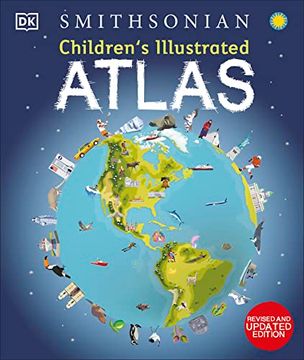
portada Children's Illustrated Atlas: Revised and Updated Edition (en Inglés)
Formato
Libro Físico
Idioma
Inglés
N° páginas
128
Encuadernación
Tapa Dura
Peso
0.57 kg.
ISBN13
9780744073881
N° edición
0002

Children's Illustrated Atlas: Revised and Updated Edition (en Inglés)

Peter Handke (Autor) · DK Publishing (Dorling Kindersley) · Tapa Dura

Children's Illustrated Atlas: Revised and Updated Edition (en Inglés) - DK

Libro Nuevo

$ 327.42

$ 654.84

Ahorras: $ 327.42

50% descuento
  • Estado: Nuevo
  • Quedan 50 unidades
Origen: Estados Unidos (Costos de importación incluídos en el precio)
Se enviará desde nuestra bodega entre el Lunes 27 de Mayo y el Martes 04 de Junio.
Lo recibirás en cualquier lugar de México entre 1 y 3 días hábiles luego del envío.

Reseña del libro "Children's Illustrated Atlas: Revised and Updated Edition (en Inglés)"

Set off on a thrilling journey around the world in this incredible atlas for kids - packed full of beautiful illustrations and photographs. Discover the world map-by-map with this exciting world atlas book for children, featuring more than 50 maps! Each page is filled with fascinating information, facts and colorful illustrations of our world. Children aged 7-9 will love to learn all about the many countries, cultures, people and animals of the world through vibrant maps. Each map is bursting with information, combining colorful icons with photographs representing key points about each country. The atlas also includes a world map poster, with a political map for each continent - and children are shown how to read a map and use a key, compass, and scale!Inside the pages of this atlas book for children, you'll find: - Information that supports the curriculum, with colorful icons and photographs that show people and places, animals, food, historical sites, industry, and habitats.- More than 50 specially commissioned maps of the world featuring countries and continents in full-color detail.- Bite-sized facts and figures about each country making it easy for children to understand.- Diagrams that compare climates, population, mountains and rivers, famous sites, and natural wonders of the world. Children's Illustrated Atlas brings the world to life with vivid maps and fascinating facts about the countries of the world, making it the perfect gift for little geographers. This charming and informative book is a key addition to every child's library.

Opiniones del libro

Ver más opiniones de clientes
  • 0% (0)
  • 0% (0)
  • 0% (0)
  • 0% (0)
  • 0% (0)

Preguntas frecuentes sobre el libro

Respuesta:
Todos los libros de nuestro catálogo son Originales.
Respuesta:
El libro está escrito en Inglés.
Respuesta:
La encuadernación de esta edición es Tapa Dura.

Preguntas y respuestas sobre el libro

¿Tienes una pregunta sobre el libro? Inicia sesión para poder agregar tu propia pregunta.

Opiniones sobre Buscalibre

Ver más opiniones de clientes